
On August 31, 2016, Utah GIS users lost their connection to the State of Utah ArcGIS networks. After many long hours of making phone calls and exerting technical genius, Meridian’s GIS Project Manager Adrian Welsh has a working alternative to help Utah GIS users access this crucial data. The following are his instructions.
How to utilize parcel data from the AGRC with ArcGIS Pro
If you have used ArcGIS Desktop (ArcMap) for utilizing Parcel data from the AGRC (Automated Geographic Reference Center), then you have probably come across this article describing the deprecation of SDE server connections (here: http://gis.utah.gov/sde-application-server-connects-deprecation/). It is past August 31, and that means the server connection is gone (for GIS users outside the State of Utah networks). While the above article goes on to show how to utilize AGRC’s GIS data from ArcGIS Online into ArcMap, this blog post will show you how to utilize this online data (particularly Parcel data) in ArcGIS Pro.
Open up ArcGIS Pro and load a new map (or use an existing one). Under the Map tab at the top, click on the Add Data button:
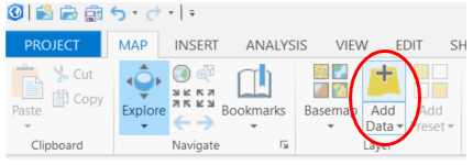
On the left hand side of the Add Data dialog box, look under the Portal category and choose the All Portal option:
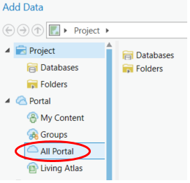
In the search box, type in “AGRC Parcels”

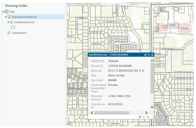
Choose the newly created “Utah Statewide Parcels” Feature Layer and then click on Select:
Because there are hundreds of thousands of Parcels in the State of Utah and this layer contains them all, it is a good idea to zoom in to a specified location in order to minimize drawing time. While this is different than how it used to be (each county was once its own layer), you can now utilize the entire state at one time which is helpful when your data spans across counties.
After it is loaded, you can treat it like you would treat your regular data:
One additional note about adding ArcGIS Online data: Oftentimes it is unclear what kind of data is being displayed in the Add Data dialog box. Here is a tip on how to know what the data types are. Open the Add Data dialog box, click on All Portal in the left hand side, type in SGID (or whatever) into the search box, then click on the three lines icon at the top, and choose Gallery:
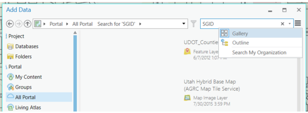
In the list of layers, now you can see what the data types are (examples include: layer, feature layer [hosted or otherwise], map image layer, layer package, tile layer [hosted or otherwise], imagery layer, etc.).
Special thanks to Matt Peters at the AGRC for getting this layer put together.


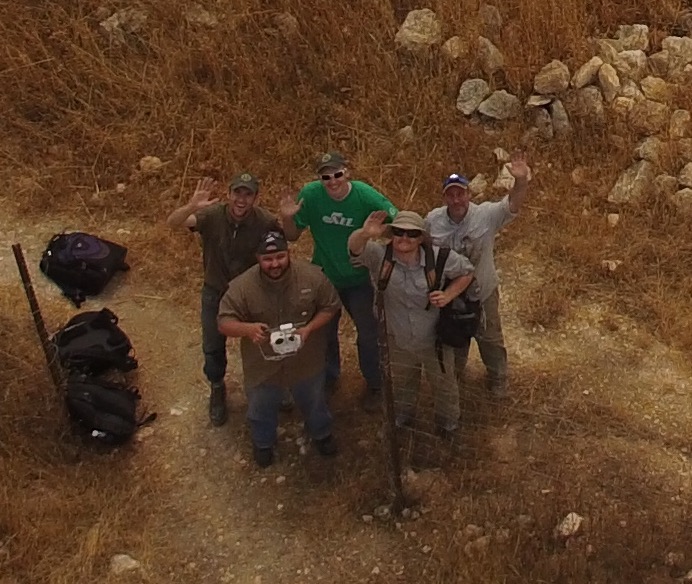
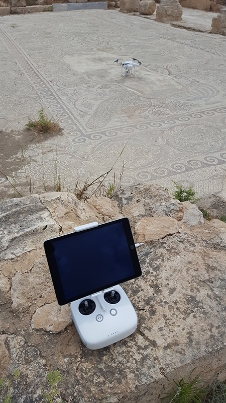
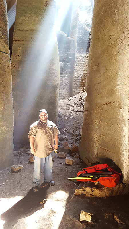
Meridian’s own Mike Nadeau took the trip of a lifetime to Israel, where he surveyed on an archaeological site called Beit Lehi. He and his peers used new technology to study ancient caverns, and in the process they stumbled across some new archaeological finds that are thousands of years old.
Mike was responsible for flying the drone used to take aerial images and videos of the Beit Lehi site. And while the drone’s batteries recharged, he helped perform LiDAR scanning (a form of radar that uses light rather than radio waves). After interviewing Mike and hearing about his experiences, his stories are best left in his own words.
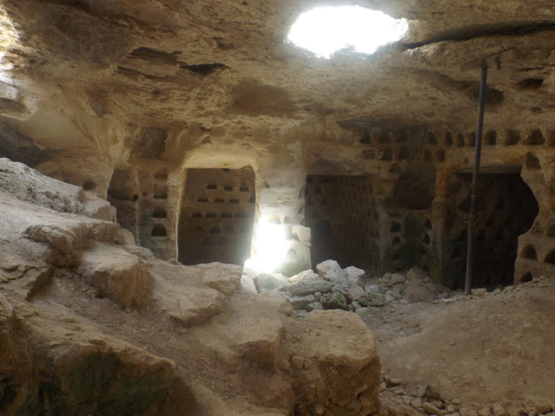
Ancient Graffiti
Salome’s Tomb
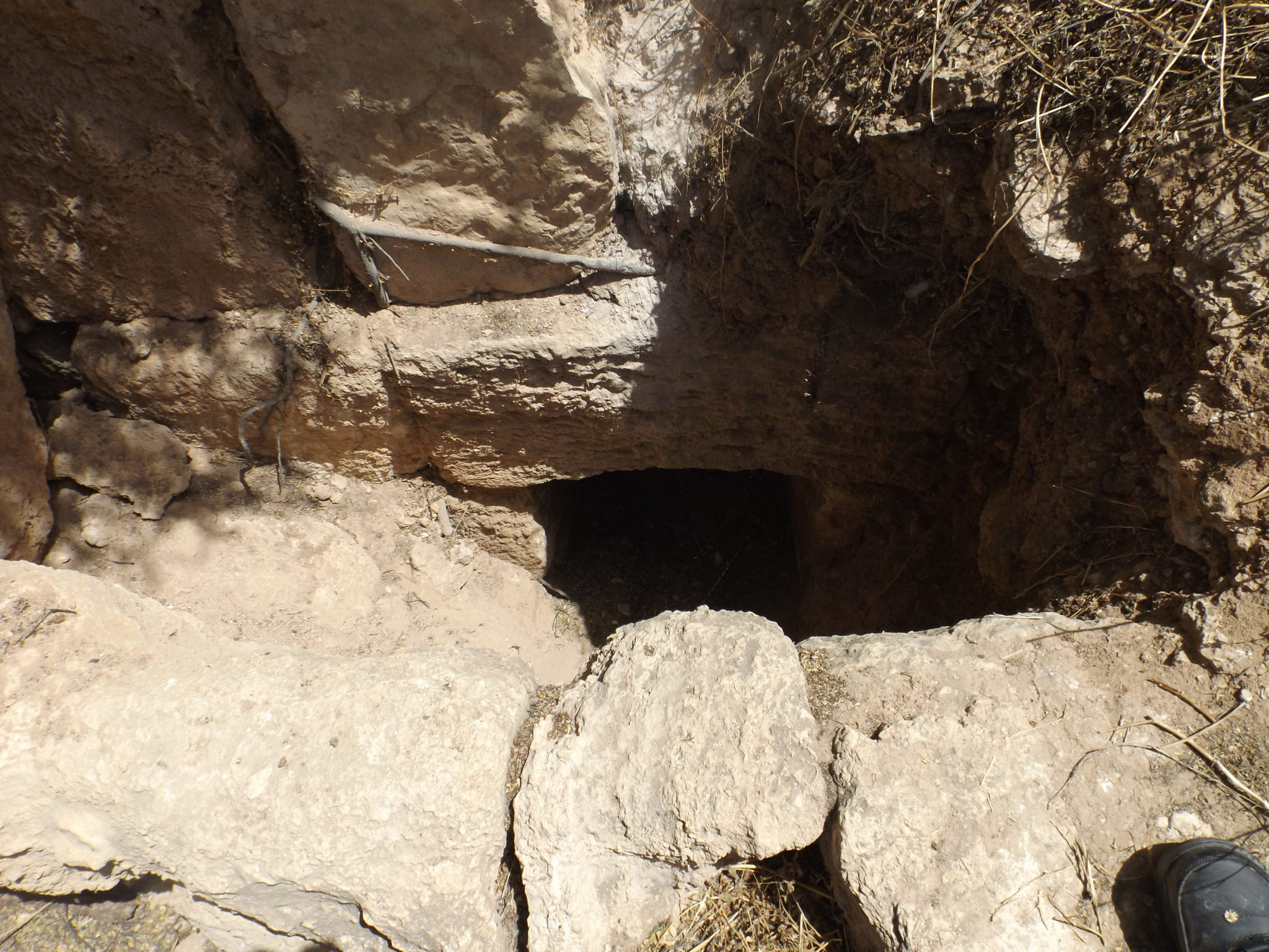
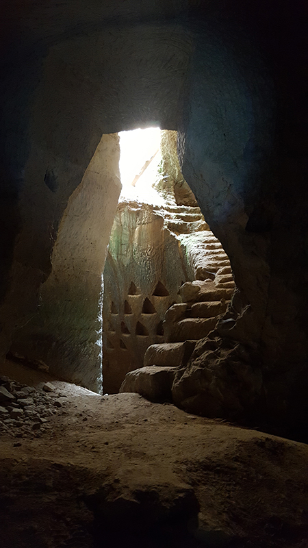
The Quarry
Inside the quarry was really musty. You could almost taste the air—it was humid and smelly. At one point, I was down there for about 4 hours while we were doing the scanning and drone flights, and I had to go up to the top for some fresh air. After I got home from Israel, I had a cough that wouldn’t go away, and I think it was because of the colder, musty air mixed with the hot dry air outside our work areas. I don’t envy the guys who had to dig out this quarry.
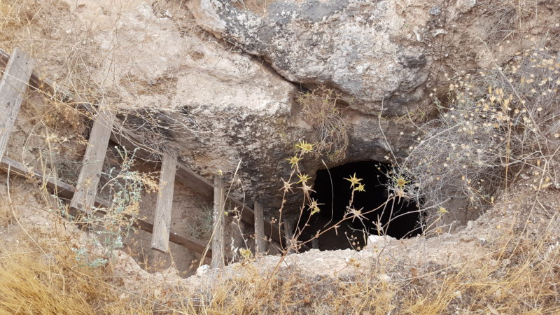
The Condo
After 2,000 Years
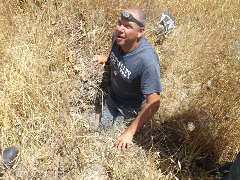
Something that happened while we were out there was that we were looking for this cavern to survey in, and Oren told us to wait in the vehicles while he walked around looking for the cavern above us. He hiked up to this really tall hill and we watched him walk around for about 10 minutes, and then he got really excited and yelled at us to come up and join him. It was a steep hike, and once we got up there we saw the foundation for what would have been another tower, just like the one above Salome’s tomb. These towers were built for strategic military purposes where you could see from one tower to the next, to the next and so on.
The Sabbath
I survey all the time. You would think that I would take something from the surveying aspect, because I’m a surveyor and that’s what we do. To me, being on the site was really cool and seeing this archaeological dig was really neat. Honestly, that wasn’t what I took away from it. What I took away from it was the outside experience—it was more of a personal experience. What I took out of it was the love for the people and their land.
By the time I left Israel, I felt something inside of me was now a part of the Israel culture in some way. No matter how little that way is, I will always yearn to go back to the land I enjoyed for those two weeks.

Two of Meridian’s own, Darrell Flake and Kurt Falkenthal, have had the opportunity to volunteer some of their time and expertise to help in the construction of Orem’s new all-abilities playground. This playground is being constructed to offer all children, regardless of physical capabilities, a place to play.
“[Working on the playground] was rewarding,” said Falkenthal. “It felt good to give back to the community. It felt good to work with other people in the community.”
“We are very community-oriented,” said Meridian Engineering’s President, Darryl Fenn. “We’re a local firm comprised of local people. We enjoy volunteering to help the community.”
The All-Together Playground is set to be completed in September 2016. Click on the link below for more information.

Brad T. Mortensen, PE, PLS recently joined Meridian Engineering as our QC/QA Manager. Brad has experience with all aspects of Transportation and Infrastructure design ranging from geodetic control, mapping, roadway design and construction of freeways and state routes, as well as state, municipal, utility and commercial/retail capital improvements. Additionally, Brad is experienced with Right-of-Way and Boundary analysis and design. Brad has worked with private entities, municipalities, and state DOTs to complete many projects throughout the western United States. He has demonstrated in these projects, that he understands our clients’ needs and will proactively work to find solutions. Recent Projects: US-189, State Park to Rock Cut Passing Lanes, Heber Co., Utah; SR-132, Salt Creek Canyon, MP36.5-37.7, Juab Co., Utah; SR-68 Redwood Road, 400 South to Stillwater Drive, Saratoga Springs, Utah; US-89, 300 South, 200 W – 700 E, Provo, Utah.
We welcome Brad to Meridian as another well-qualified professional ready to serve your needs!