At Meridian Engineering, we understand the importance of land surveying. As a land surveyor in Utah, we specialize in providing accurate and reliable surveying services in all kinds of terrain. This article will discuss the different types of land surveying and help you better understand the critical role this service plays across various industries.
Meridian Engineering—Land Surveyor, Utah
Meridian Engineering is a leading land surveying company in Utah. Our team of experienced and licensed professionals provides high-quality surveying services ranging from boundary, aerial, control network, bathymetric, topographic surveys and LiDAR scanning. Our knowledge of the survey/mapping and right of way design industry, and of the State laws governing the profession, continually represent our clients well. We offer a wide range of surveying solutions to help meet your project’s needs.
“The professional land surveyors and survey support staff at Meridian are adept and well versed with the necessary and unique client requirements and documentation standards to deliver the professional quality required for a diverse range of projects including municipality, transportation and Federal (BLM, DNR, BOR, USFS) projects. Our field crews have dedicated thousands of hours in the field utilizing the latest technology to collect quality data quickly and efficiently, ensuring accurate measurements for real estate and construction projects. Our office staff have the education, knowledge and expertise to analyze and resolve boundary issues, research chains of title of when needed, and develop topographic surveys used in design and construction across the Intermountain West. We are mathematicians, historians, project managers, advocates, engineers, and even chainsaw operators with intellectual prowess and adventurous attitudes. We are committed to delivering precision, accuracy, quality, and passion for our clients.”
– Michael Nadeau | Professional Land Surveyor (PLS), Certified Federal Surveyor (CFedS)
What are the Types of Land Surveying?
Each type of land surveying serves a specific purpose in different industries. Some common types of land surveying include the following:
Boundary Surveying
Boundary surveying determines property lines and corners. This type of survey establishes accurate boundaries for landowners, resolves property disputes, and defines real estate transactions.
Surveyors use documents called “legal descriptions” to define township grids and pinpoint the location of the parcel. Meridian Engineering offers the required format for legal descriptions, confirming parcel ownership, ensuring the appropriate conveyance forms are used, and verifying the geometry with area and closures that align with the legal descriptions. Various land purchasing documents, such as sales contracts, deeds, property tax statements, mortgages, and Records of Survey, rely on legal descriptions for accuracy and clarity. By using legal descriptions, we can minimize confusion about where boundaries begin and end.
To guarantee the most complete and accurate deliverable, Meridian Engineering follows a strict
QA-QC process in conducting boundary surveys and providing legal descriptions for clients.
Topographic Surveying
Topographic surveying involves measuring the elevation and contours of the land to create detailed maps showing natural and manufactured infrastructure. These surveys provide critical information about the terrain and existing features of the land.
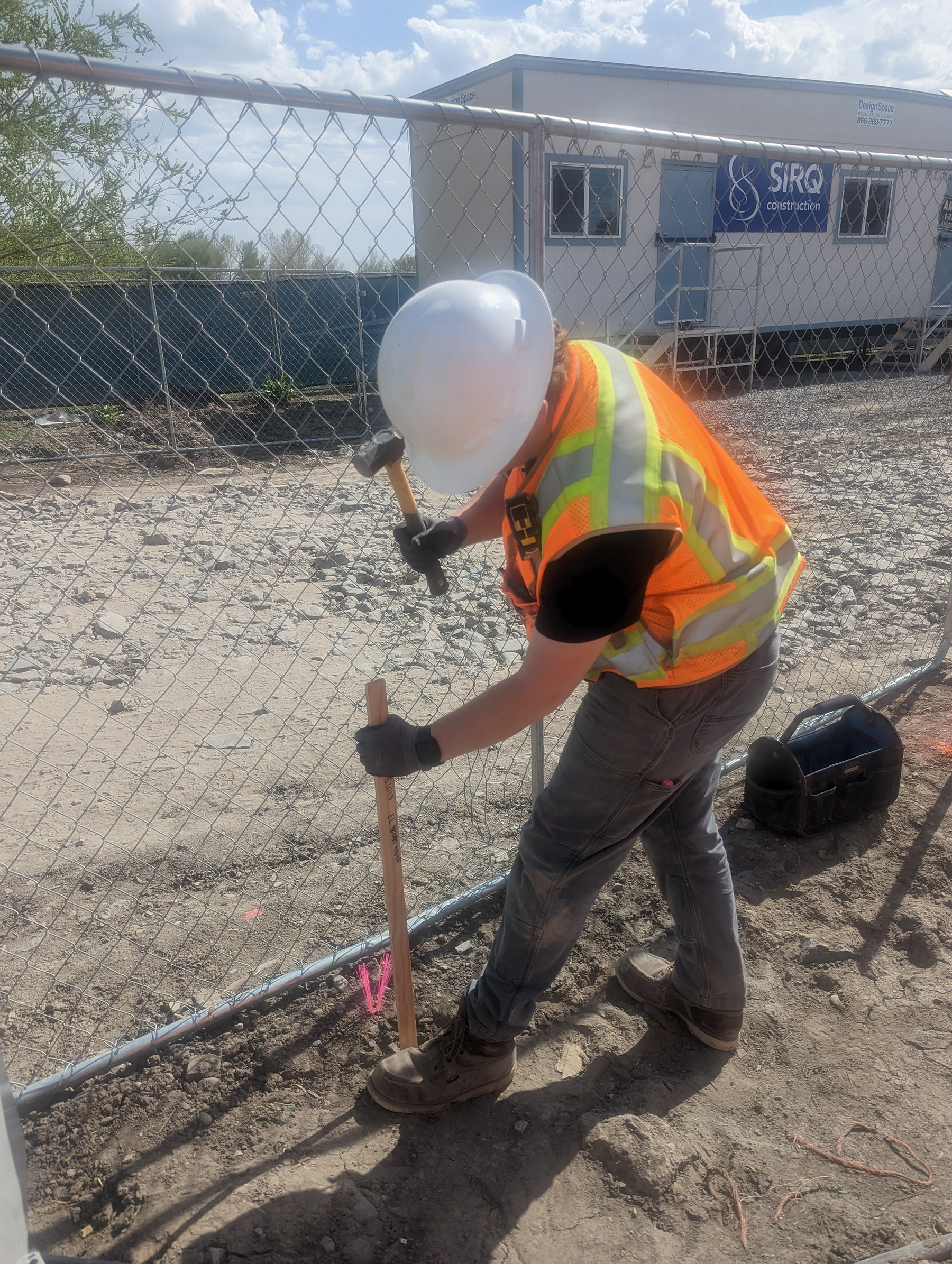
Construction Surveying and Staking
Construction surveying guides the placement of buildings, roads, and other structures for precise layout during construction projects. This type of survey ensures that construction activities proceed according to the design plans and specifications. It helps to prevent errors and ensure a project’s structural integrity.
ALTA/NSPS Land Title Surveying
When performing ALTA Land Title Surveys, Meridian understands the process of providing detailed land parcel mapping while showing existing improvements, easements and encumbrances of the property, utilities, and significant observations concerning the property boundaries. The Meridian Engineering team has extensive experience conducting ALTA/NSPS land title surveys for our clients, ensuring compliance with the standards set by the American Land Title Association (ALTA) and the National Society of Professional Surveyors (NSPS).
Subdivision Land Surveying
Subdivision land surveying involves dividing a parcel of land into smaller lots to establish boundaries, easements, and other legal aspects for new developments. They give developers and property owners the information needed to create new subdivisions or developments. At Meridian Engineering, we offer expert subdivision land surveying services to help our clients navigate the complex land subdivision process and ensure compliance with local regulations and zoning requirements.
Control Surveys
Control surveys involve establishing a network of reference points with real-time latitudes and longitudes to serve as a basis for additional surveys of a specific area. State plane coordinates are calculated from these values. Project coordinates are then developed and used for actual topographic surveys. Elevations are based on GPS observations that are computed from the static network-adjusted ellipsoid height and the current geoid model.
Bathymetric Surveys
Meridian uses Sonar technology for detailed bathymetric surveys of the lake bottoms, canals or slow moving river channels. This technology is typically used for river crossings or even new marina ramps or extensions, and can be used to determine both the lake bottom “surface” and a second penetrating layer below any muck or organic layer, resulting in a more detailed lake survey for increased accuracy in project earthwork and permitting.
Other Surveys
Other specialized surveys serve specific purposes in various industries, such as transportation, mining, energy, and environmental management. Accurately conducting them can require specialized knowledge and equipment.
The type of survey needed and its purpose will significantly affect the cost of the survey. When you contact Meridian Engineering, you can get a detailed and accurate quote about your land survey project. Our team will work with you to determine the best survey for your project and provide a competitive quote that aligns with your budget.
What tools are used in land surveying?
Land surveyors rely on various tools and techniques to collect data. These tools help us accurately measure the crucial distances, angles, elevations, and locations of a plot of land.
Total Stations
Total Stations are electronic instruments used to measure angles and distances with the help of lasers or infrared light. They also have a built-in distance and angle measurement system to help surveyors accurately measure horizontal and vertical angles. Total Stations provide precise measurements, making them a valuable tool for land surveyors.
GPS/GNSS Receivers
GPS/GNSS receivers use satellite signals to determine precise locations on Earth. GPS/GNSS receivers have multiple satellite antennas that receive signals from various satellites orbiting the Earth. By analyzing these signals, the receiver can calculate its position with high accuracy. Surveyors commonly use GPS/GNSS receivers in land surveying projects that require precise location data, such as boundary surveys, topographic surveys, and construction staking.
Levels
Levels measure elevations and slopes on the land. They come in various types, including automatic, digital, and laser levels. Land surveyors often use automatic levels due to their ease of use and accuracy. These levels use a compensator mechanism to ensure that the line of sight remains horizontal, allowing surveyors to measure elevations and slopes accurately.
Measuring Tapes and Rods
Measuring tapes and rods determine distances on the surveyed land. Measuring tapes come in various lengths, materials, and designs. Measuring rods and measuring tapes also measure heights and depths on the land. Surveyors use measuring tapes and rods in boundary surveys, topographic surveys, and construction staking.
Software
Surveyors use software for data processing, mapping, and analysis. Survey software allows surveyors to create detailed maps, reports, and drawings based on the collected data. Surveying software comes in various types, including CAD, GIS, and surveying-specific software. CAD software can create detailed drawings and plans, while GIS software maps terrain and conducts spatial analysis. Surveying-specific software tailored for land surveying projects includes features like coordinate geometry calculations, data processing tools, and reporting capabilities.
Meridian Engineering’s land surveyors use various tools and techniques to collect data for various land surveying projects. The accuracy these tools provide makes them indispensable for surveyors and their work.
What is the process of land surveying?
Our land surveying process at Meridian Engineering follows a systematic approach to ensure accuracy and precision in data collection. This process involves several key steps that guide our team through the entire surveying project.
At Meridian Engineering, we conduct our land surveys systematically to ensure accurate and precise data collection. The land surveying process typically involves the following steps:
- Research
During the research phase, we gather existing records and maps of the area to understand the history and characteristics of the land in question. We review property deeds, historical maps, aerial photographs, and other relevant documents to gain insights into the boundaries, topography, and features of the land. Research helps us establish a starting point for the survey and provides valuable information that guides us in the subsequent survey phases.
- Fieldwork
Fieldwork includes traveling to the land needing a survey to get on-site measurements and observations. We use expert tools and techniques to collect data on distances, angles, elevations, and locations. Fieldwork requires careful planning and execution to ensure accurate measurements and data collection. Our team works collaboratively to gather comprehensive data that forms the basis for calculations and mapping.
- Calculations
After collecting data from the field, we use the information and make the necessary calculations to determine the precise locations of points on the land. We analyze the data using mathematical formulas, coordinate geometry calculations, and surveying software and calculate coordinates, distances, areas, and elevations. Calculations help us accurately define boundaries, establish reference points, and create a survey plan that reflects the true characteristics of the land.
- Mapping
Mapping creates a visual representation of the survey results to help clients and stakeholders understand the survey data. After completing the needed calculations, we make maps to visualize the survey results. Mapping involves translating the survey data into graphical representations that depict the land’s boundaries, features, and topography. We use CAD software, GIS software, and other mapping tools to generate detailed maps, drawings, and reports that convey the survey findings effectively.
- Record of Survey
All Records of Survey plats are prepared according to Standards set forth by the Utah Society of Professional Land Surveyors and accepted in Utah as the standard of care in conducting surveys.
Possible encroachments, gaps or overlaps with adjacent properties are shown, signed and stamped copies of the survey are shared with the client and filed as a signed/stamped copy of this boundary survey in the County Surveyor/Recorder Office per State Code.
Following this systematic process and incorporating the latest technology and equipment, we deliver high-quality land surveying services that meet our client’s needs and contribute to completing land development projects.
Professional land surveyors at Meridian Engineering use a variety of field equipment, such as Trimble Data Collectors and Receivers, Phantom 4, M-300 and Trinity Pro Fixed Wing UAVs (drones), total stations, robotic total stations, and CAD software like Civil-3D to create plats. The survey includes determining property boundaries, preparing maps, and plotting sites, with a final record of the survey being recorded in the respective county surveyor’s office.
Why is land surveying important?
Land surveying helps ensure accuracy and efficiency, playing a critical role in various aspects of today’s society, including the following:
Property Ownership
Land surveyors help prevent disputes over property ownership by establishing legal boundaries. Detailed land surveys provide property owners with peace of mind, knowing that their land boundaries are accurately marked and legally recognized.
When considering purchasing land, enlist the services of a professional surveyor. A survey of the area will provide proof of what you are buying and confirm the boundaries of the property lines. Additionally, a survey can help determine if any structures on the property comply with zoning and neighborhood regulations. Zoning information will also reveal any existing easements and provide necessary legal descriptions.
At Meridian, our survey crews have extensive experience conducting surveys of various sizes. From design grade surveying of existing surfaces to mapping, ALTA/ACSM Land Title Surveys, utility investigations, boundary and easement determination, and subdivision platting, we offer a range of services to inform further development of your property. Trust Meridian for accurate and reliable survey information to protect your property ownership rights.
Resource Management
Land surveying also plays a vital role in resource management by mapping natural resources and environmental features. By conducting surveys of land and water resources, environmental engineers can assess the health of ecosystems, track changes over time, and identify potential areas for conservation or development. With accurate survey data, decision-makers can make informed choices about managing and protecting valuable resources for future generations.
Planning and Development
Land surveying helps create accurate maps for plotting and zoning, which is crucial for the planning and development of towns and cities. Urban planners, developers, and government agencies rely on survey data to make informed decisions about land use, development, and zoning. By conducting surveys of topography, boundaries for future infrastructure, planners can create detailed maps that sustainably and efficiently guide a community’s growth and development.
With accurate survey data, projects can avoid delays, errors, and disputes that can have far-reaching consequences.
Land Surveying Expertise at Meridian Engineering
At Meridian Engineering, we prioritize professionalism and adhere to the strict standards of practice set forth by state boards. Our Professional Land Surveyors have the expertise required to ensure the accuracy and reliability of our surveys.
Michael Nadeau, our Survey Manager, holds the prestigious title of Certified Federal Surveyor (CFedS), allowing Meridian to support clients on a wide range of land surveying projects, including those involving tribal lands and other federal interest lands. Michael oversees that Meridian Engineering upholds the highest standards of professionalism and delivers exceptional surveying services to all of our clients.
Land Surveying, Utah
If you require a professional land surveyor in Utah, contact Meridian Engineering for expert surveying services tailored to your needs. Our skilled professionals will assist you with all your land surveying requirements and provide accurate and reliable surveying solutions for your project.
Contact Meridian Engineering today to learn more about our services and how we can help you succeed in your next project. Let us take the stress out of surveying so you can focus on bringing your vision to life. https://www.meiamerica.com/contact/ or info@meiamerica.com