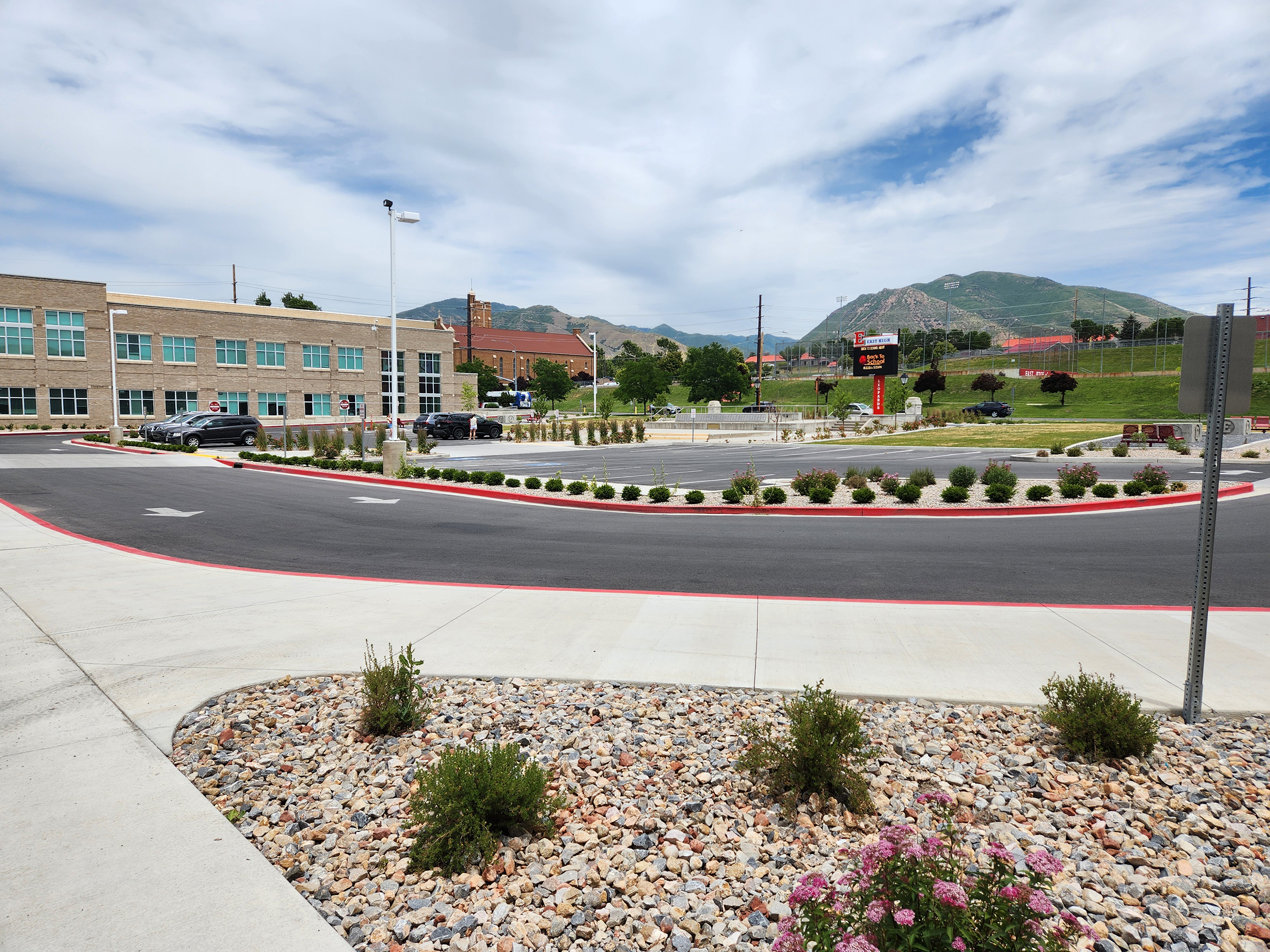
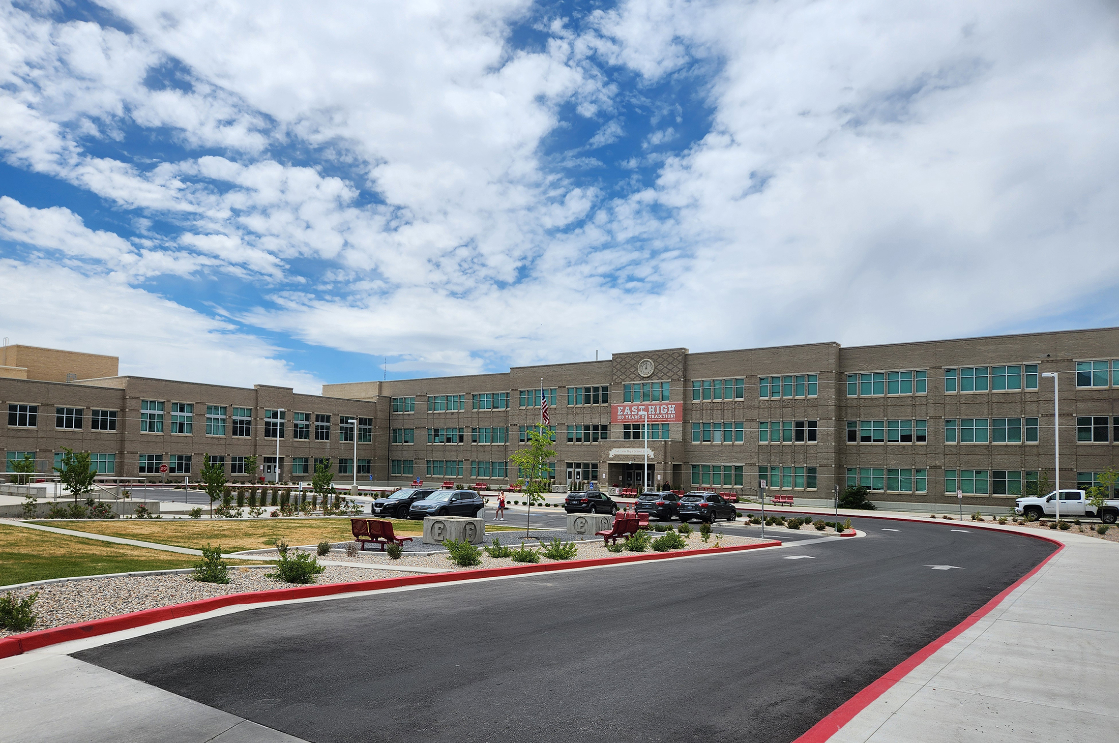
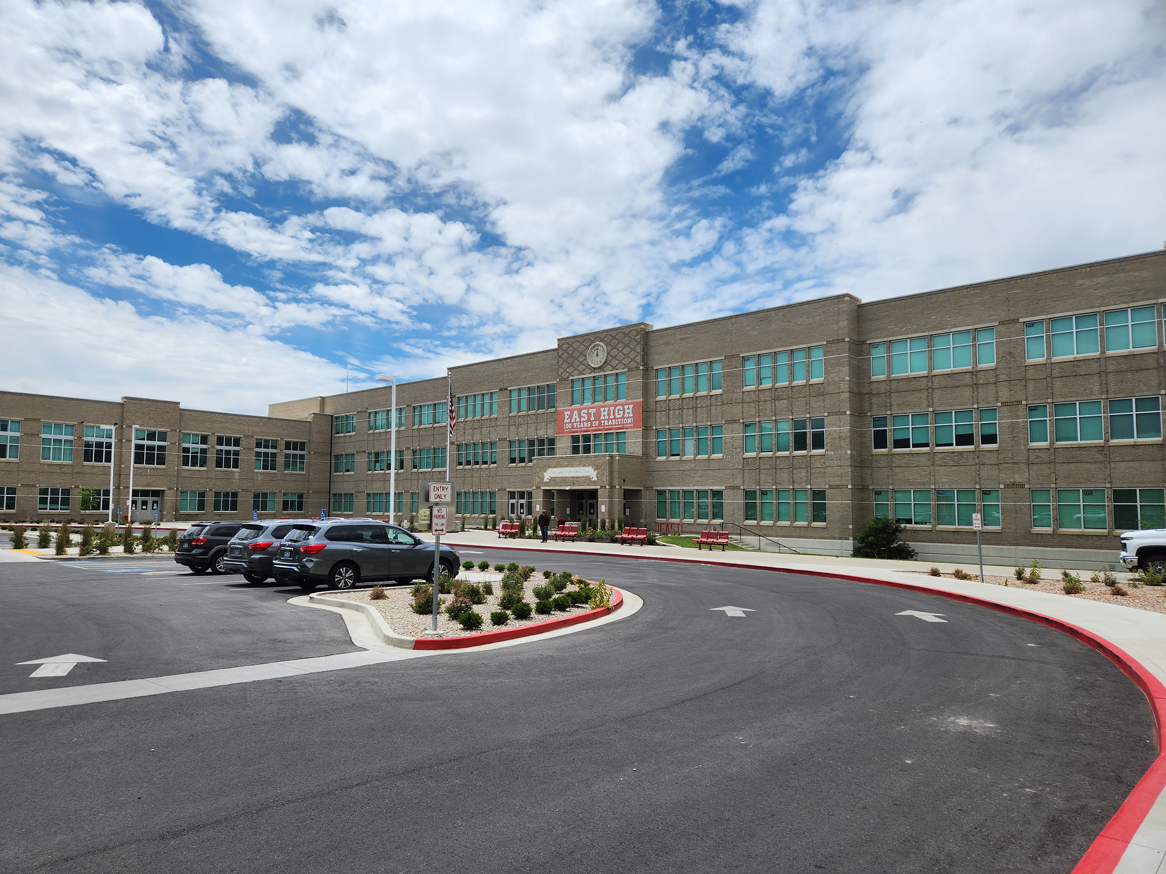
Category

Project Progress

Meridian and SLC Department of Airports Collaborate to Map Project Site

By Project Progress

As the surveying and base mapping sub-consultant working under prime consultant, HNTB, Meridian field crews and office staff have been working with Salt Lake City Department of Airports on one of the most complicated topographic surveys in Meridian’s 25-year history. Extensive coordination has been required between the airport’s project management and operations teams, HNTB staff, and the FAA to fly inside active airspace over the project site with an unmanned aerial vehicle (UAV) to gather Aerial LiDAR and Aerial Imagery without disrupting plane flights.


This project was a remarkable culmination of coordination, teamwork, and patience to facilitate the UAV flight missions, while avoiding peak aircraft flights and bad weather conditions such as wind and snow during a record-breaking Utah winter 2023. By using every tool in the toolbox, including digital levels, robotic total stations, GPS, sonar for bathymetric surveys, terrestrial LiDAR, airborne LiDAR, and some all-around technology savvy field crews coupled with knowledgeable office personnel, Meridian has completed a product to meet the design teams needs and ensure the project meets all regulatory requirements. Base mapping efforts of the project are complete.

Once the project team has progressed the design to a point of substantial completion, Meridian staff will create legal descriptions and vacation documentation for the next stages of development.

Have you been to the new Jeanne Wagner Jewish Community Center Activities Center and Outdoor Athletic Complex yet?

By Project Progress

This new Activities Center and Outdoor Athletic Complex addition for Salt Lake City’s Jewish Community consists of a two story 10,000 square foot facility providing both an outdoor and indoor place for kids to enjoy awesome activities from basketball and volleyball to fitness classes and even summer camps. It is nestled in at the north of the existing Jewish Community Center at 2 N. Medical Drive -north of the UU campus.


The final product is designed to fit into a sloped site by ajc architects and serves as structurally sound and modern sleek environment with natural light and open spaces. Construction by United Contractors.

The civil engineering design provided by Meridian included demolition plans of existing Tennis Courts for the new facility, utility design for new water and sewer services, site grading and stormwater management plans to connect existing infrastructure and consolidation of property and preparation of utility and access easements.

Entrance of the new activity center addition

Meridian is loving its M300 drone’s ability for achieving high accuracies over large areas at a relatively low cost to clients.   

By Project Progress

Meridian Senior UAS Pilot Freeman Marble, sUAV FAA part 107 remote licensed uses new drone technology for mapping a local project west of Salt Lake City of the existing area for future design and construction. M300 technology coupled with a P1 camera and Rock Robotic LiDAR sensor can efficiently classify raw point cloud data using Photogrammetry and LiDAR into actionable data sets for engineers and architects to use as a base for design documents.


 These processes even help with transportation-related projects as it assists with the pavement inspection process by identifying utility markings in the road without the danger of being in the travelled roadway. It can scan to identify panels of concrete, walls, and bridges that need to be replaced or repaired while maintaining pilot safety from roadway and traffic.

Check it out in use:

https://youtu.be/RpKSOZpsaeo

https://youtu.be/ZttTeimOpgk


Meridian uses LiDAR scans for Spanish Fork High School construction accuracy.   

By Project Progress

During construction in the auditorium of the new high school, Meridian’s Brian Boehmer scanned the steel for the balcony to obtain a 3D model of the as-constructed beams in impressive detail.  Currently, the school is having precast concrete generated for the balcony which requires verification that the precast concrete will fit the beams as they were installed. The LiDAR scans generate precise, three-dimensional information about the shape of an object or surface in a short time.


The point cloud (shown) is used to create a 3D model of the extracted beams in AutoCAD Civil3D that the architect can use for verifying whether the concrete will fit. 


Check out these mountain views captured in the Big Cottonwood Canyon by Meridian field crews as they perform survey work along the corridor.   

By Project Progress

Meridian is providing surveying, mapping, right-of-way design, and easements throughout the entirety of Big Cottonwood Canyon SR 190 from the mouth of Big Cottonwood Canyon up to and including the Brighton Loop and Guardsman’s Pass. Our deliverables include Base Mapping of existing pavement and boundary evidence to develop ROW Plan Sheets that were certified for UDOT’s inventory system and can be used for future ROW design reference. Project management requires heavy coordination with US Forest Service, FHWA, and UDOT. The status of the project is about 45% complete.


Photography by Geoff Bippes, Survey Crew Chief